Blencathra (868m) from Mungrisdale via Sharp Edge - 02/11/2018
Distance: ~15km, Ascent: ~700m, Time: 4 hours
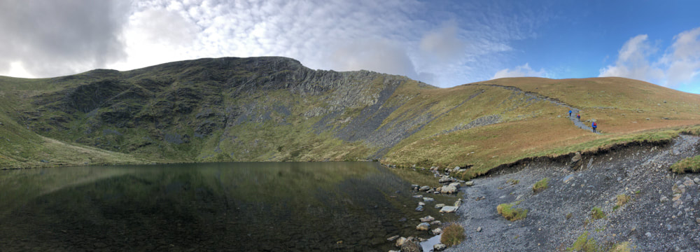
I have heard stories of Sharp Edge and Alison and I have viewed it from above, when walking Blencathra on a previous occasion. Since Alison had vowed never to attempt it and I was alone for this visit and the weather was fine - I decided that today was the day. I started from Mungrisdale where there is a small car park opposite the village hall with a £2 parking fee to be paid into an honesty box in the wall of the hall. The first few km follow the north and west banks of River Glenderamackin; and the first 1.5km or so of the path have been heavily eroded by flooding, with frequent digressions upslope to avoid bootfulls of mud. To ascend via Sharp Edge I crossed the river on a footbridge at White Horse Bent, where the track does a long zig-zag to reach the saddle between Souther Fell and Scales Fell. From here the track diverges with one path ascending Blencathra via the ridge of Scales Fell (this was my descent route) and the other, leading to Sharp Edge follows the south-west bank of the valley. Once past Scales Beck the route ascends steeply south of the prominent rocky outcrop of Bruns Knott to reach the banks of Scales Tarn - from where the views of Sharp Edge are impressive - and where I paused for a snack. There is an escape route for the faint-hearted that ascends Blencathra south of Scale Tarn.
Looking back towards Mungrisdale along the Glenderamackin valley
|
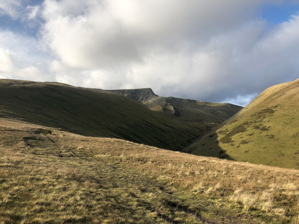
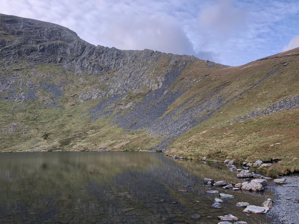
Sharp Edge and Blencathra come into view from the saddle between Souther Fell and Scales Fell
|
Sharp Edge and Scales Tarn
|
|

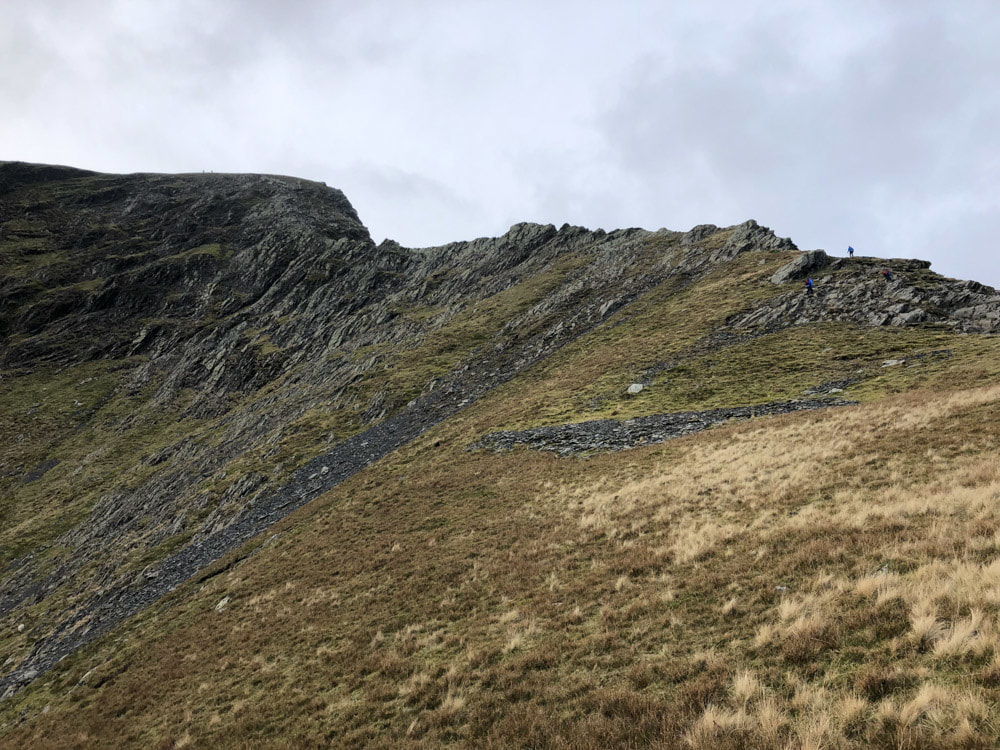
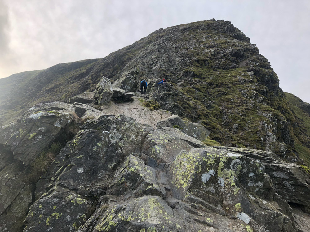
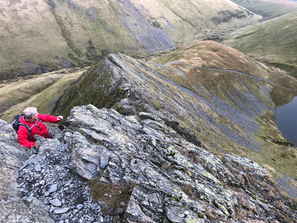
Most of Sharp Edge is a steep scramble
|
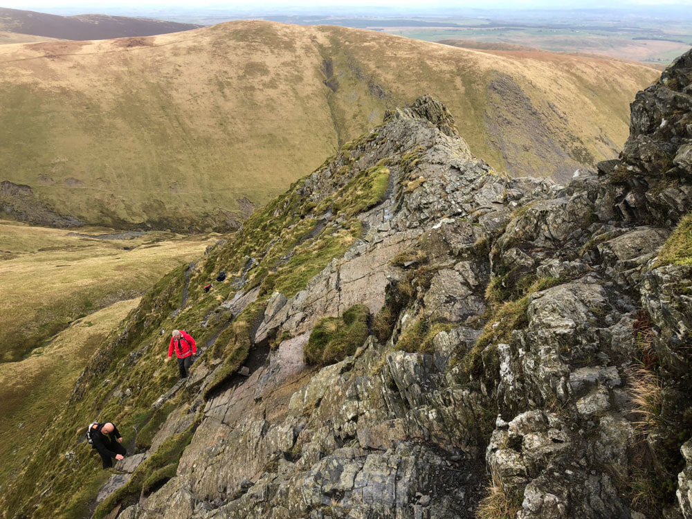
Looking back from part-way up Sharp Edge
|
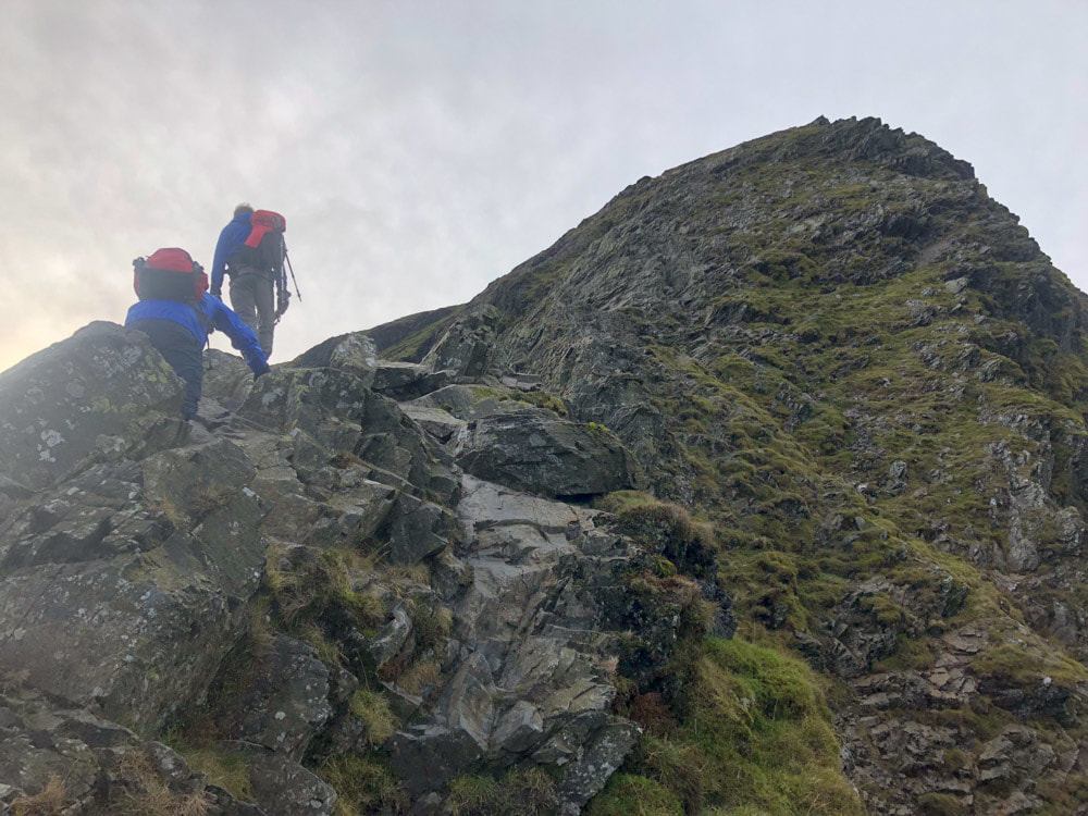
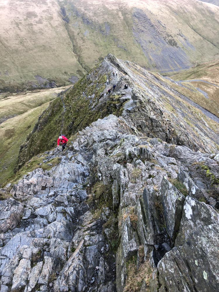
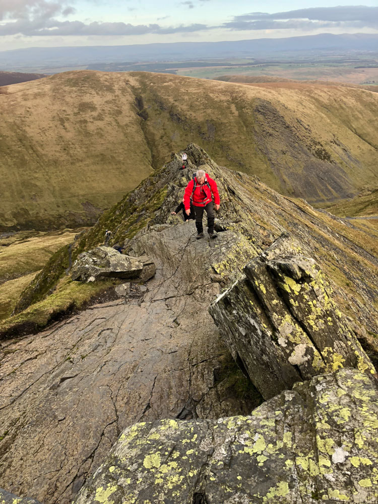
Looking on to the steepest section of Sharp Edge
|
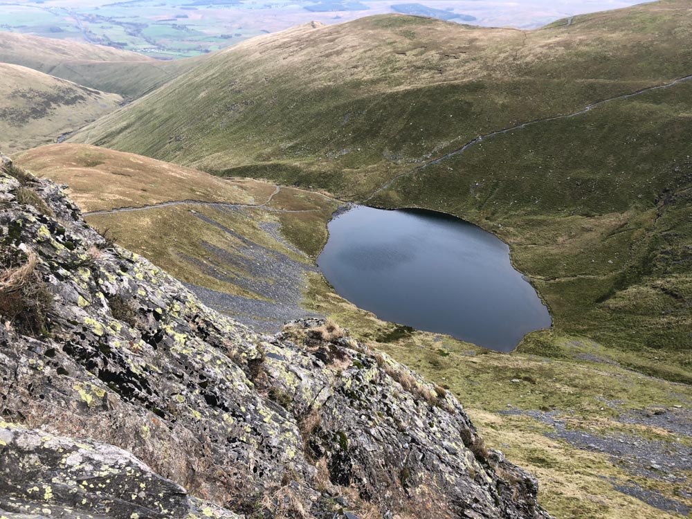
scales Tarn from Sharp Edge
|
|
|
Well that was probably the longest scramble I've done in the Lake District, nowhere particularly technical, but steep drop-offs and quite exposed - definitely not to be done in windy, wet or icy conditions and definitely not a descent route. As can be seen from the photos other people also decided that today was a good day for Sharp Edge. Once at the end of Sharp Edge the rest of the ascent to the summit of Blencathra is very straightforward
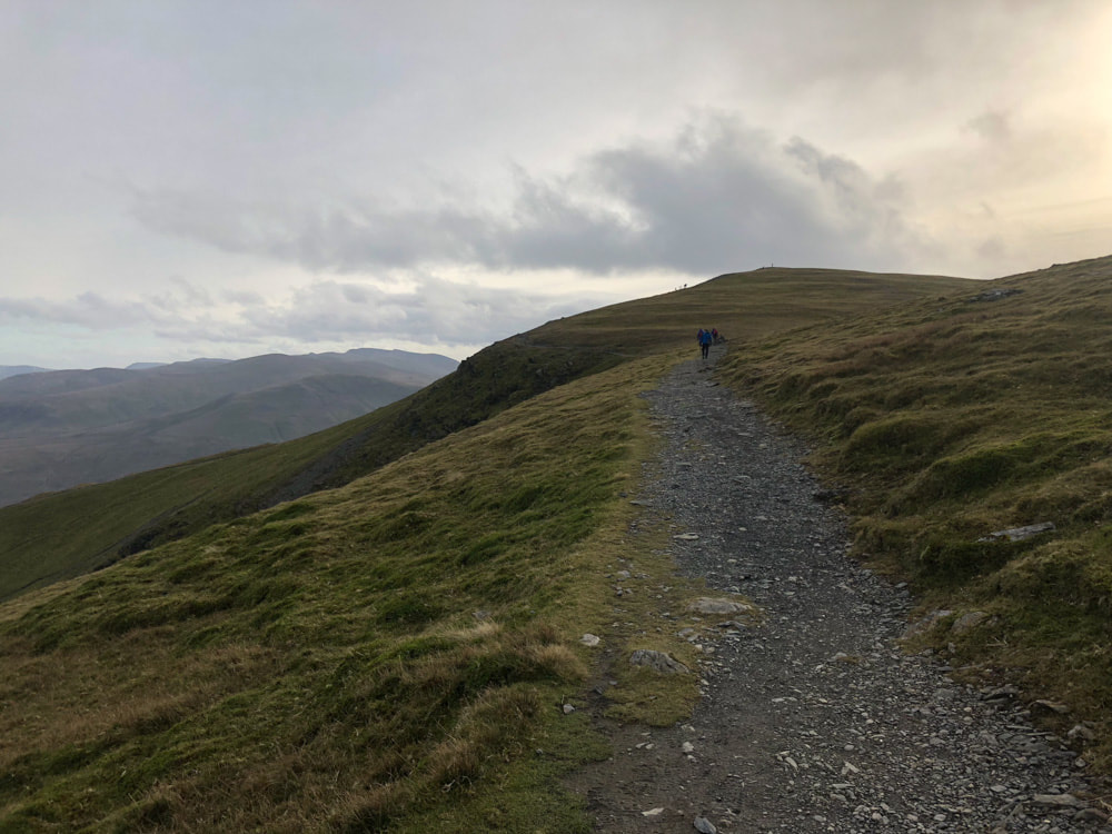
Blencathra summit from the main Blencathra path above Sharp Edge
|
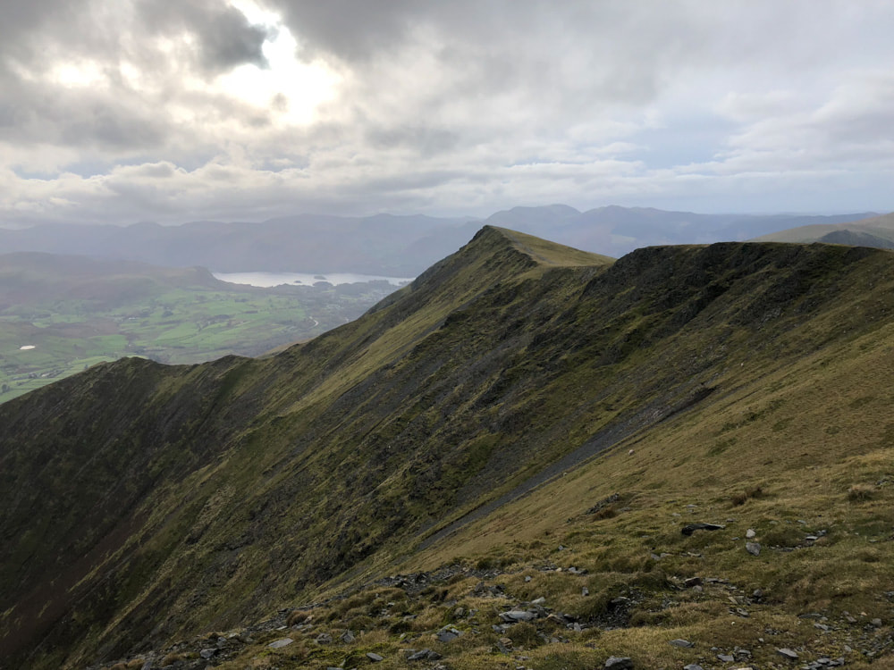
The Blencathra Ridge and Derwent Water from near the summit of Blencathra
|
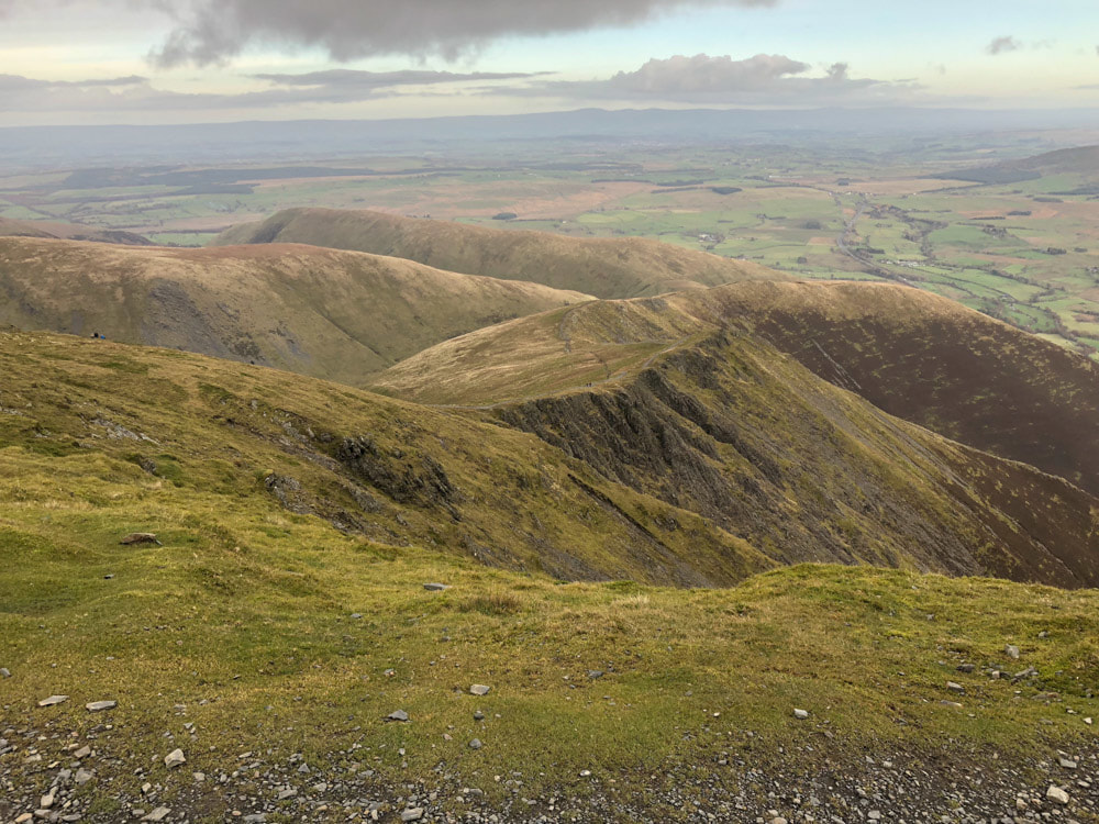
Much of the descent route can be traced in the image above: The sinuous ridge of Scales Fell is right of centre; from here my path continues across the ridge that descends to the right of the image to rejoin the saddle between Scales Fell and Souther Fell. Souther Fell is the furthest ridge - the path ascends to the ridge and continues NE along it for a while. There is no clear path between the ridge path on Souther Fell and the path that descends its North-Eastern flank to return to Mungrisdale (which is at the far left of the fell as seen in the image) via Low Beckside - so a bit of judgment is required about when to leave the ridge track. Continuing along the ridge track, takes you over the 'summit' (really just the highest point of a plateau) of Souther Fell and on in the direction of Mungrisdale and to within 100m or so of the pub - but there is no path from here to the pub and it is necessary to turn to Low Beckside before you can get on the road back to Mungrisdale (an unwelcome 1.5km detour just when you think you've got back).
